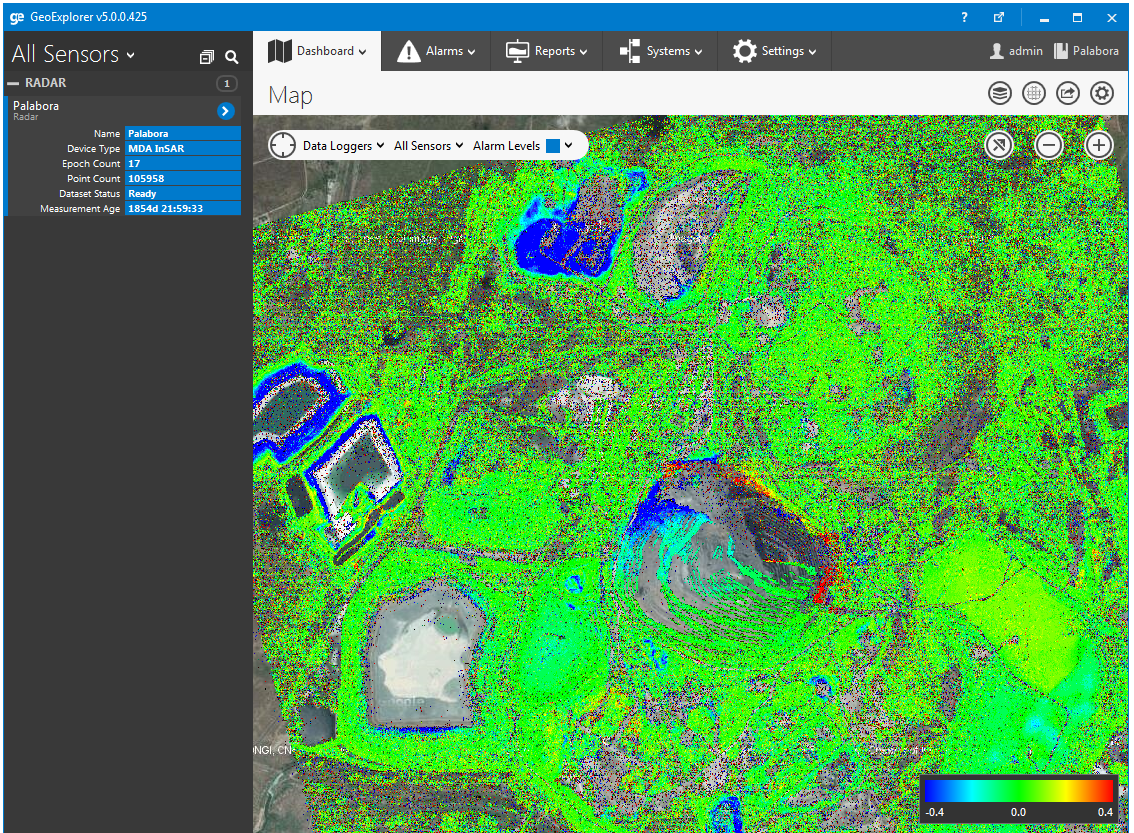
Our new GroundProbe Module seamlessly synchronizes radar data and alarms from GroundProbe’s SSR-Viewer software. This not only allows GroundProbe customers to view data from multiple radars on one screen, it also enables them to combine slope stability radar data with information from their other monitoring systems, such as, total stations and GPS, all within NavStar’s acclaimed GeoExplorer platform.
The GroundProbe Module is result of a close software development partnership between NavStar and GroundProbe and together we have achieved an exceptionally high level of integration between both companies’ technology. GroundProbe customers now have access to the GeoExplorer platform and to all of the features and benefits that it offers for viewing, interacting and reporting on radar data including:
- One dashboard for viewing multiple radars
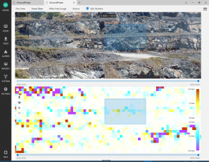
- Switch between front views and plan views
- Merge current and historical data sets
- Integration with other sensors
- Drag-and-drop reporting
- Multi-user flexibility
More information about the GeoExplorer GroundProbe Module is available on GroundProbe’s website.