Products ![]() Monitoring Hardware
Monitoring Hardware ![]() GPS & GNSS Sensors
GPS & GNSS Sensors
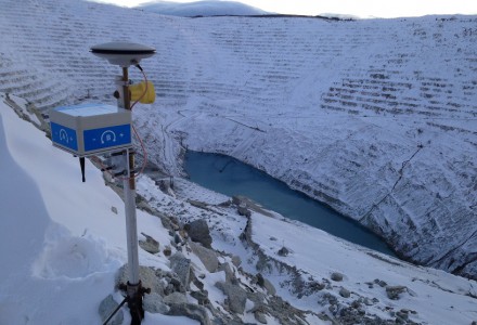
NavStar’s suite of GPS/GNSS sensors (GMS700 & GMS800) can be rapidly deployed for three-dimensional displacement and tilt measurements for deformation monitoring in extreme climates and a variety of geospatial applications.
With no moving parts and the ability to provide 24/7 automated monitoring data in extreme climates, GPS/GNSS sensors are an ideal choice for monitoring slopes and structures such as, open pit mines, dams, landslides and other hazards.
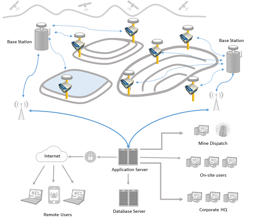
NavStar’s GeoExplorer platform can be used to measure three-dimensional displacements using an array of GPS/GNSS receivers either as a stand-alone monitoring solution or as part of a sophisticated integrated system including a wide variety of other monitoring equipment.
Hundreds of NavStar’s GPS/GNSS sensors have been deployed world-wide and these have been successfully used on long-term projects in inhospitable environments. The experience we have gained has enabled us to develop both hardware and software that has been specifically designed to meet the demands of our customers. As a result, we provide reliable, functional systems which can be rapidly expanded and easily maintained by the end-user.
NavStar offers two different power options for monitoring applications.
GMS700—BATTERY-POWERED—FEATURES
-
- Single 68AH 14.4v Lithium Battery Pack with a lifespan of up to 3 years*
- Real-time data and real-time monitoring
- Fast and low-cost installations with minimal system components
- Superior cost-benefit returns to project budgets
- Biaxial tilt accuracy of <0.01°
GMS800—SOLAR-POWERED—FEATURES
-
- Rechargeable power system requires only 30 min of sunlight per day for 24/7 operation
- Real-time data and real-time monitoring
- Fast and low-cost installations with minimal system components
- Superior cost-benefit returns to project budgets
- Biaxial tilt accuracy of <0.01°